The Storm Prediction Center is refining the area where severe weather is possible this afternoon and evening. While they still have a meaningful chance for a tornado in Northern Michigan, they are finding reasons to be concerned about 2- inch diameter hail.
As I talked about yesterday, I still feel the current severe weather forecast outline extends about 50 miles too far south. I guess it’s good to play it on the safe side and just have the chance of severe thunderstorms in the back of your mind.
First off, if you are going to be in southern Lower Michigan today, you don’t have a risk of severe thunderstorms. You could have a weakening severe thunderstorm overnight tonight.
The severe weather threat increases as you go north into the northern third of Lower Michigan, and also into the eastern half of the Upper Peninsula. The jetstream is located just north of the Upper Peninsula and has strong winds in it. The jetstream is the vacuum that pulls air upward from the ground, and gets thunderstorms going and thriving. I’ll give you more on that in a bit.
Let’s look at where the severe weather is possible according to the Storm Prediction Center (SPC).
Let’s start with the most likely severe weather type in thunderstorms this afternoon and evening. Large hail is possible with these thunderstorms. Hail is possible in the northern half of Lower Michigan, and again- I would probably shift this whole area 50 miles north, taking it out of Saginaw and covering the eastern U.P. We will get an update from SPC by 1 p.m. The black hatched area is significant. That is the area they think two inch diameter hail is possible. Two inch hail damages a car and can damage house siding.
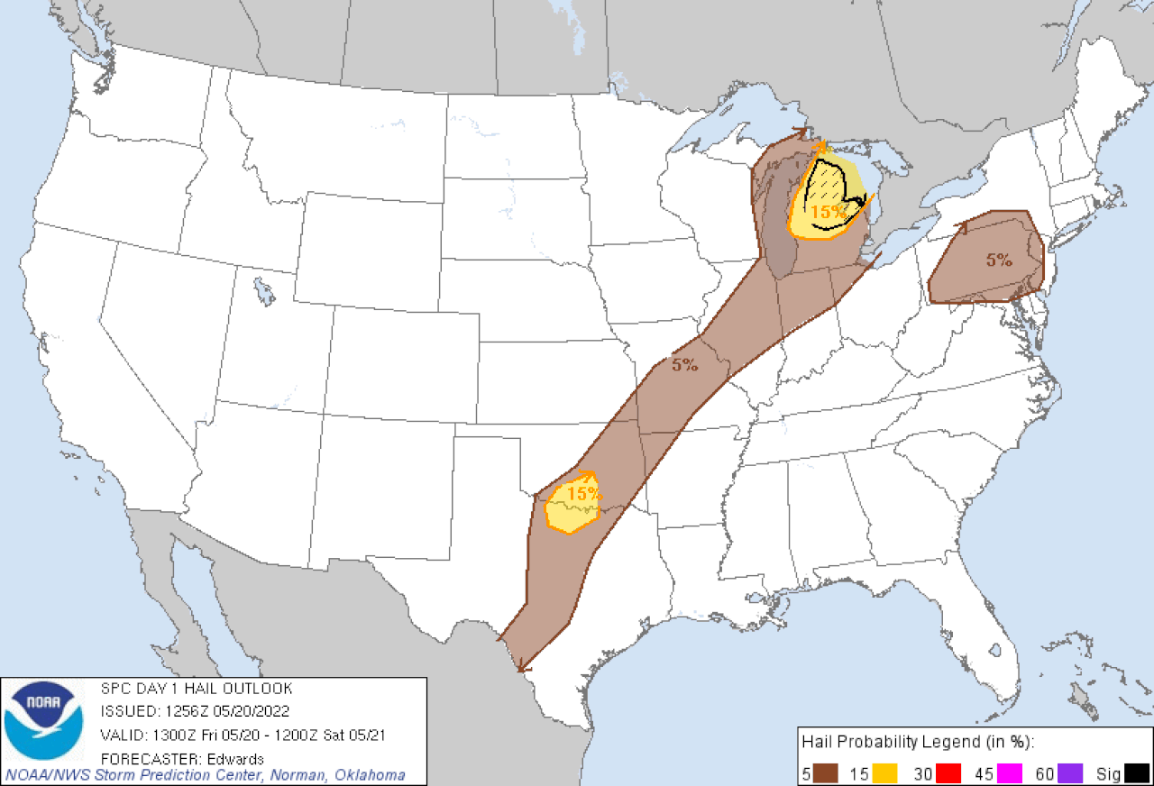
Percent chance of large hail in thunderstorms. The black hatched area over northern Lower has a 10 percent chance of two inch diameter hail or larger. (source: Storm Prediction Center)
SPC says there is enough wind shear to create supercell thunderstorms, and the chance of an isolated tornado. The brown area has a five percent chance of a tornado. Again, I would shift this north 50 miles, keeping the same shape and moving it into the eastern U.P. But the Storm Prediction Center has a lot of forecasting tools, and they are generally the experts on placement of severe weather. A local meteorologist in the area can have a little better feel about where the severe weather may set up.
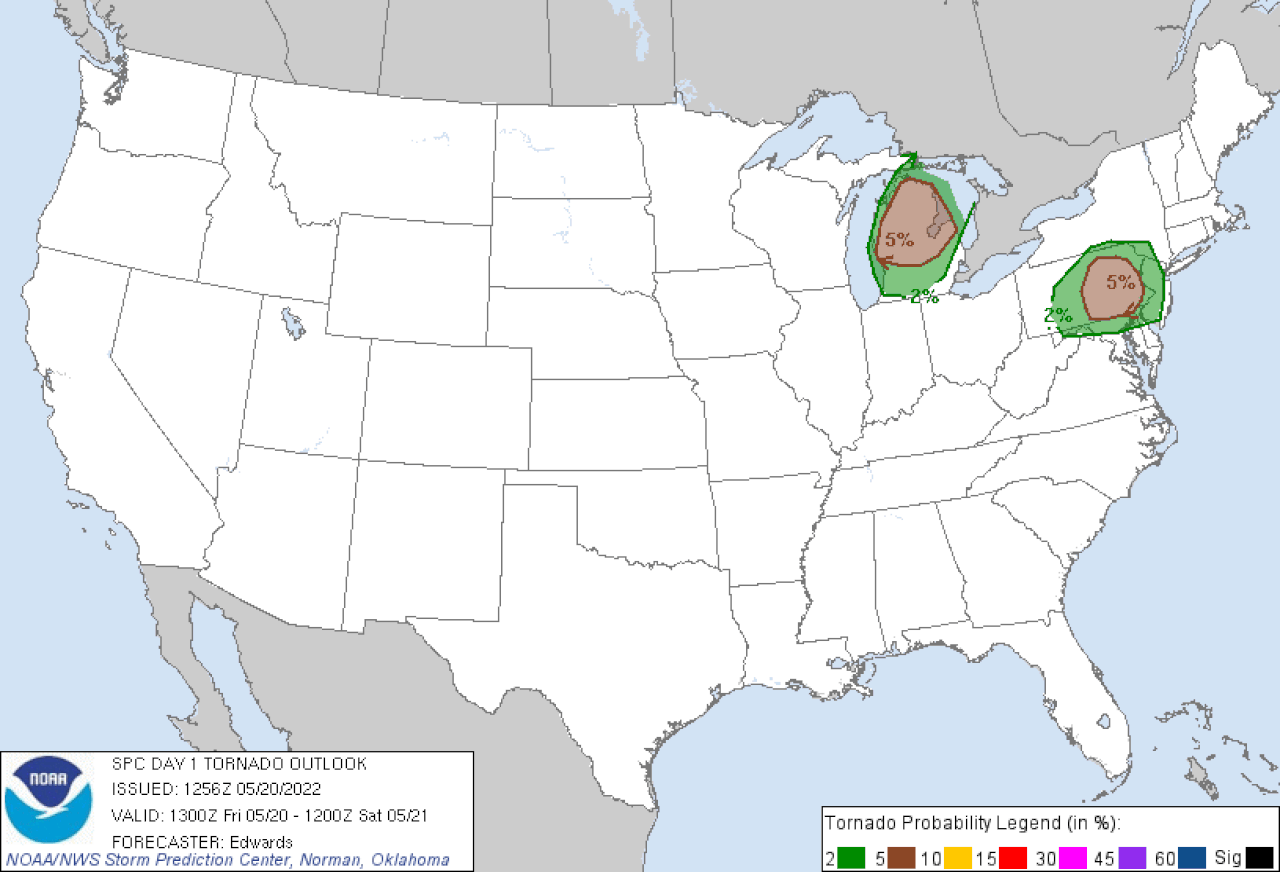
Percent chance of isolated tornadoes in thunderstorms. Froecast is for Friday afternoon and evening. (source: Storm Prediction Center)
Of course with severe thunderstorms you can experience very quick, high wind gusts. The forecast just below again shows the same northern Michigan area with the highest chance of a possible severe wind gust.
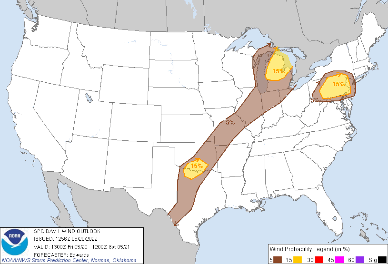
Percent chance of isolated 58 mph or stronger wind gusts in thunderstorms. (source: Storm Prediction Center)
Why do I think the Upper Peninsula is the main target? The jetstream is just north of the U.P. The most important area for severe storms is just south and just west of the strongest part of the jetstream. Just below is the jetstream forecast for 9 p.m this evening.
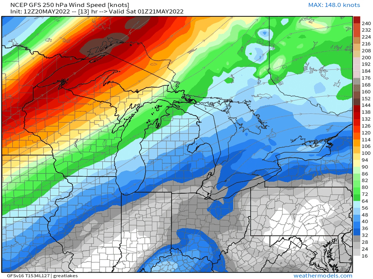
Jetstream forecast for 9 p..m. Friday, May 20, 2022
The brown shaded areas north of Lake Superior are winds of 170 mph. At that time the most favorable area for severe storms would be over western Lake Superior, northern Wisconsin and the U.P.
Severe storms also need hot temperatures and high humidity. In this case the hottest, most humid weather will be in southern Lower Michigan.
So we might have the two big ingredients for severe storms not in the same area.
I would still be on alert for severe thunderstorms across northern Lower Michigan and the eastern U.P. based on future radar forecasts from the better severe weather models.
Look for updates this afternoon, and stay updated here.
George is Digismak’s reported cum editor with 13 years of experience in Journalism